Ushguli
უშგული
Four Svan villages at 2,200 m, with medieval stone towers and the Shkhara glacier as backdrop. UNESCO World Heritage since 1996.
Location in the Caucasus
Description
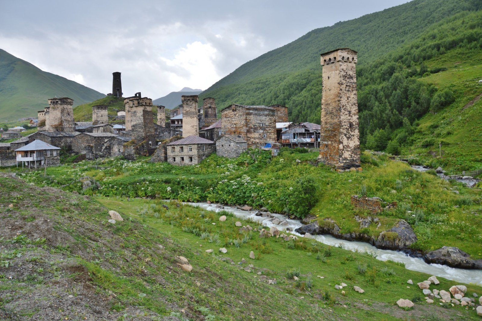
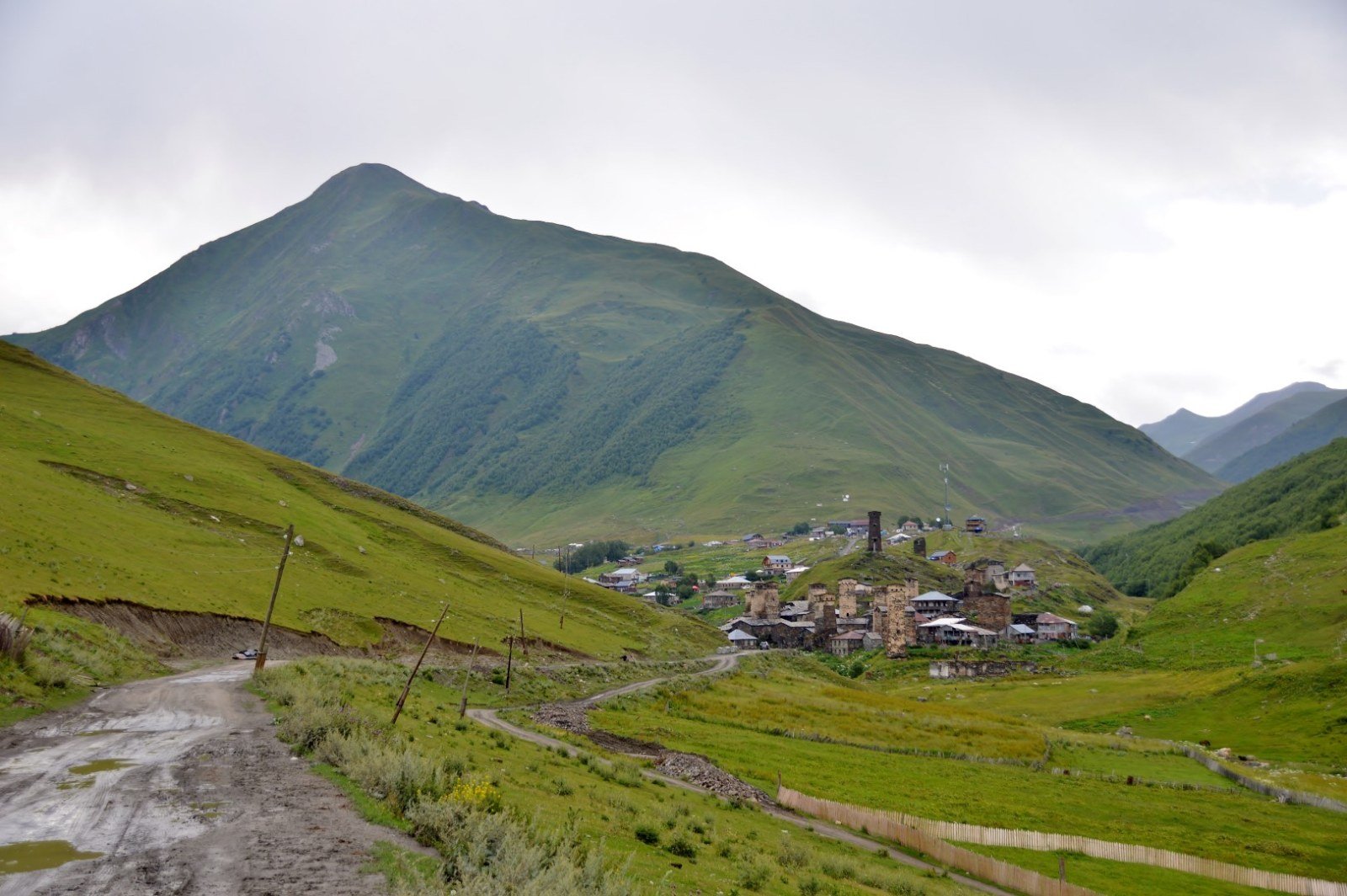
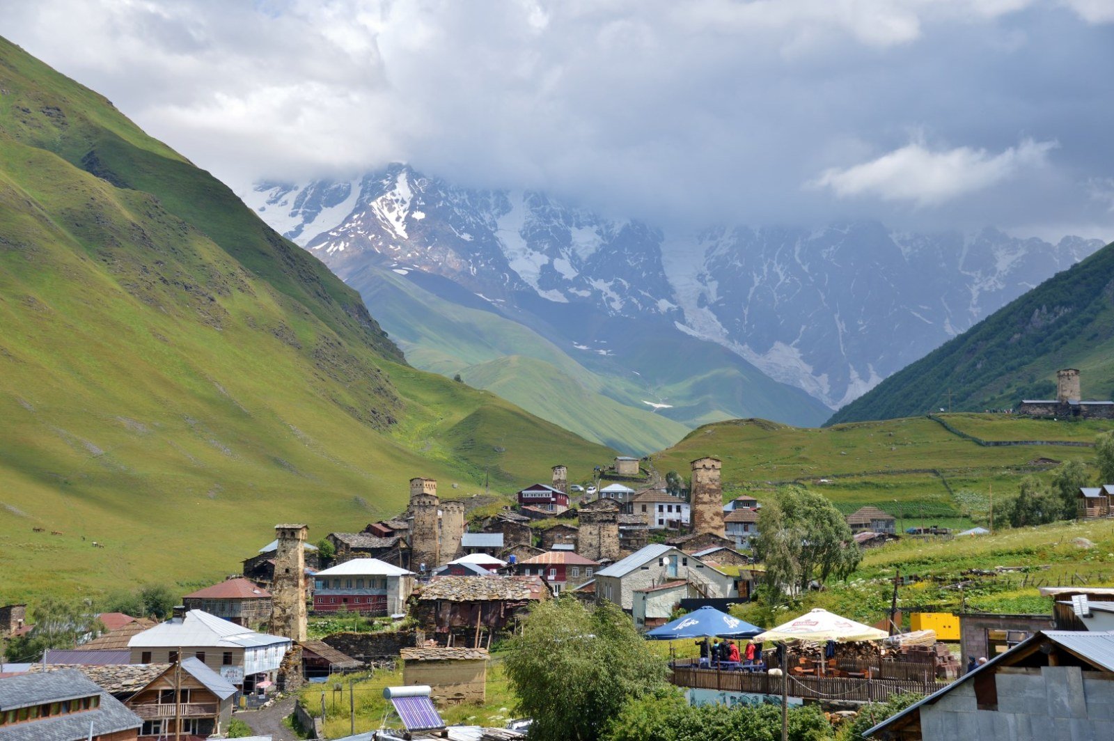
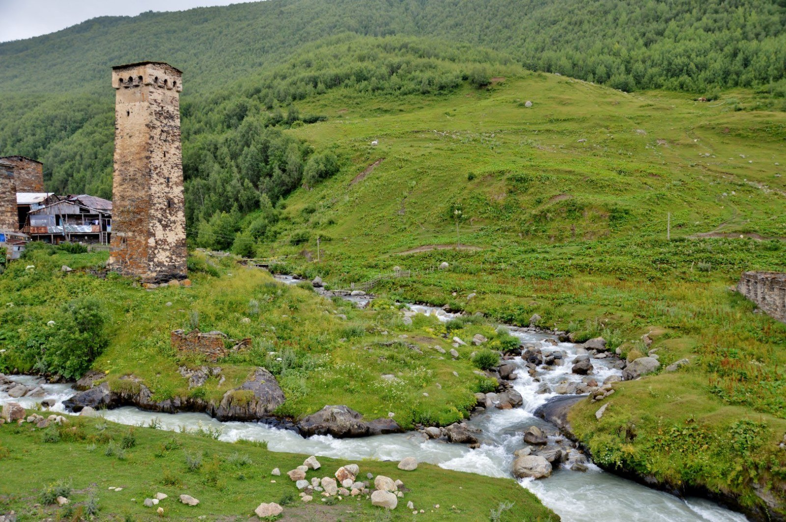
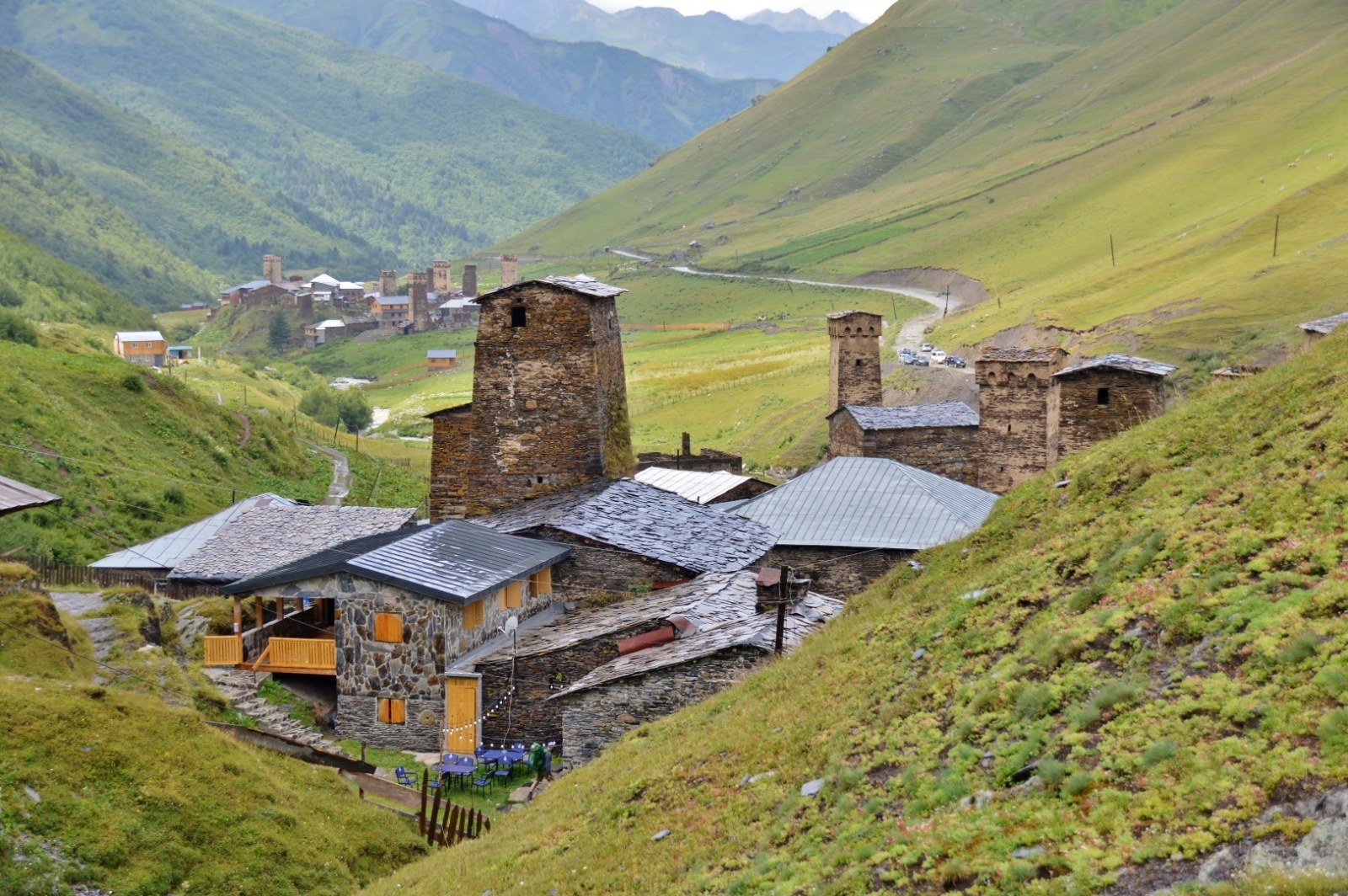
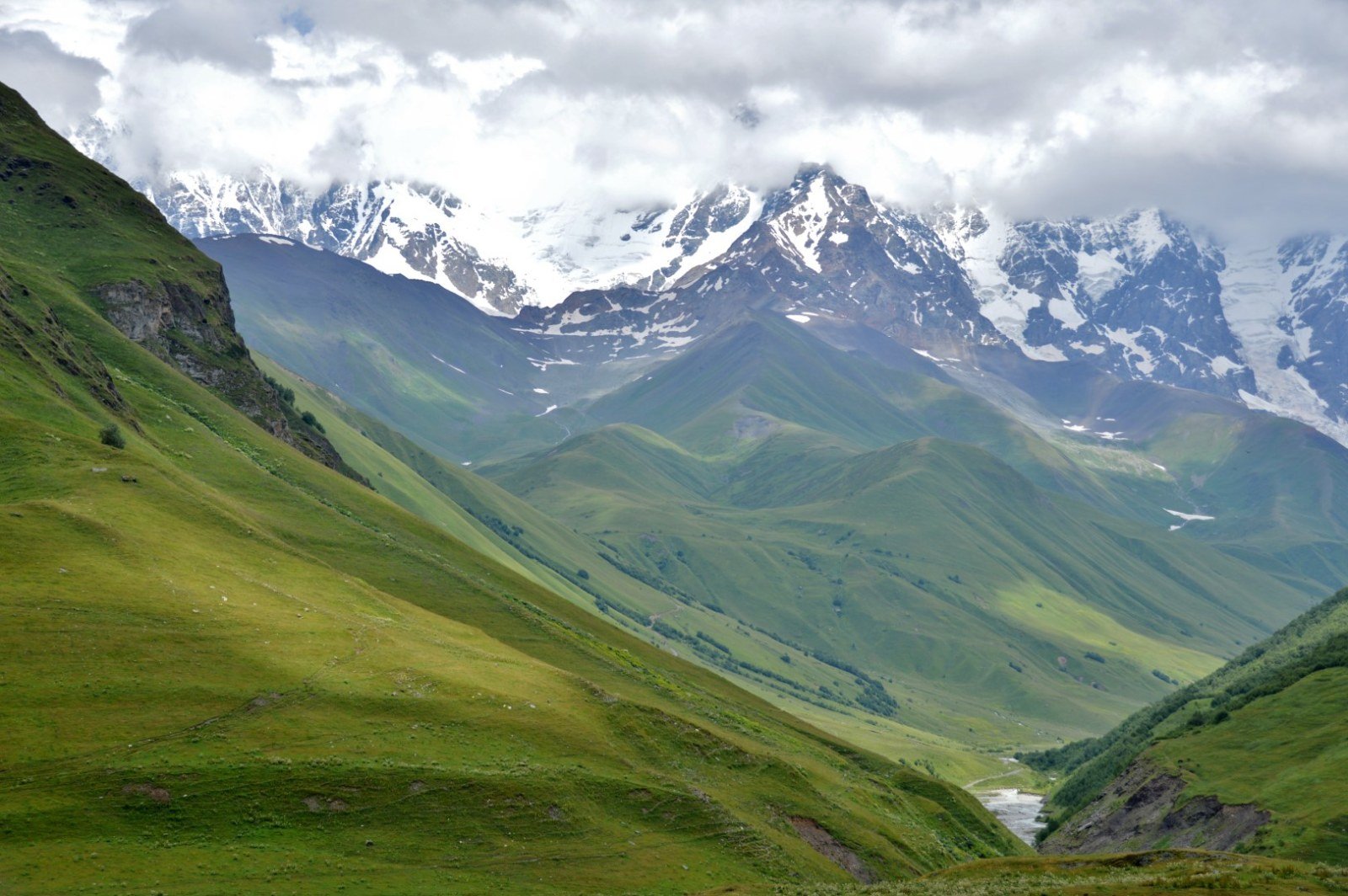
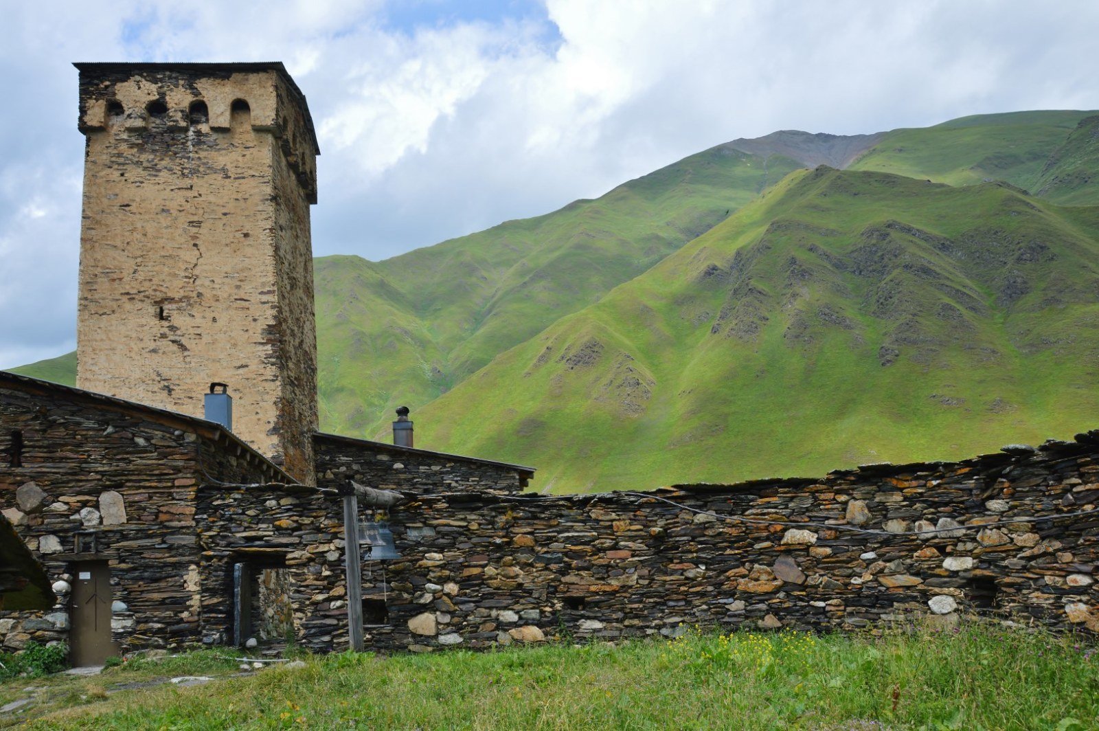
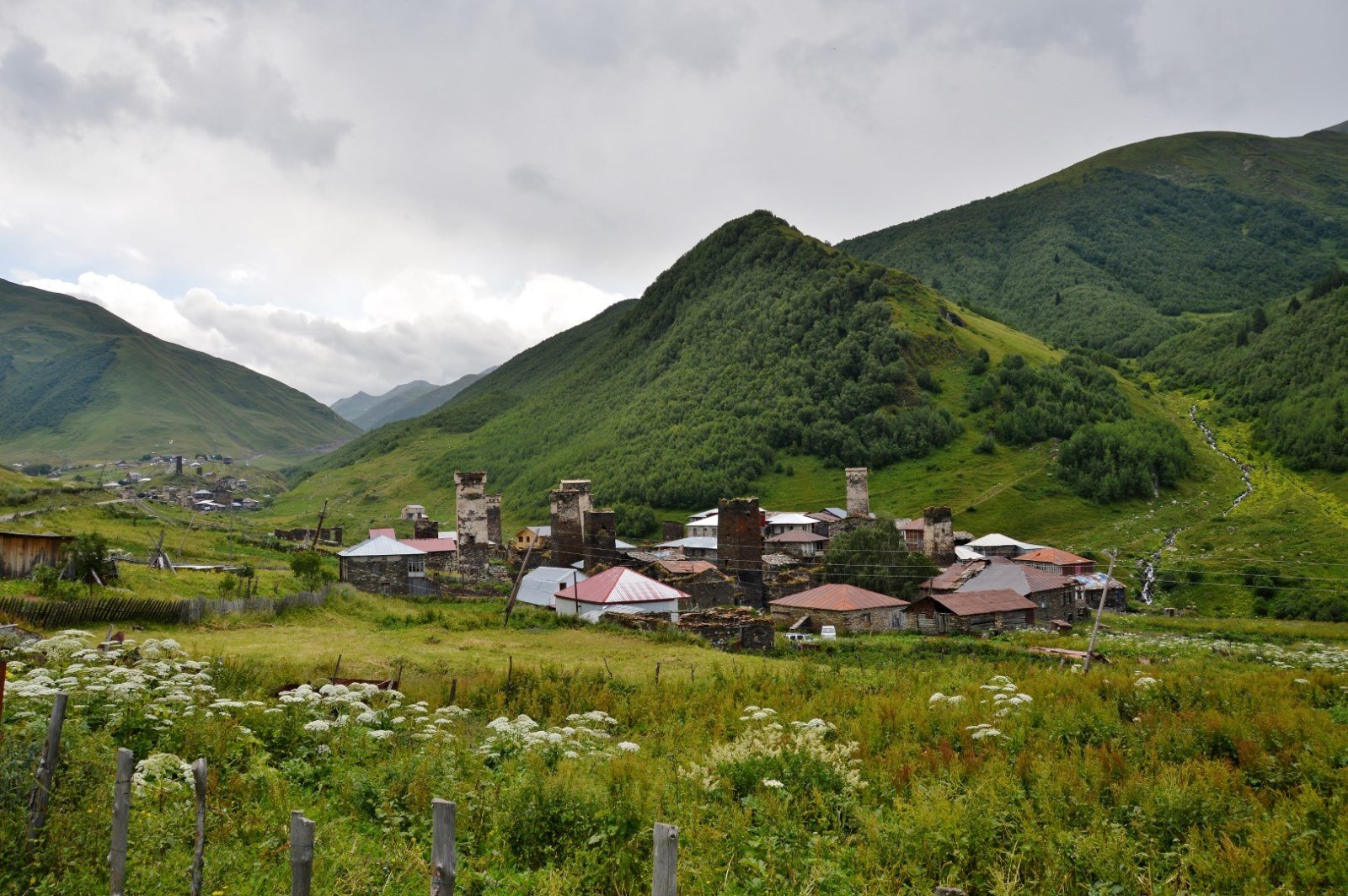
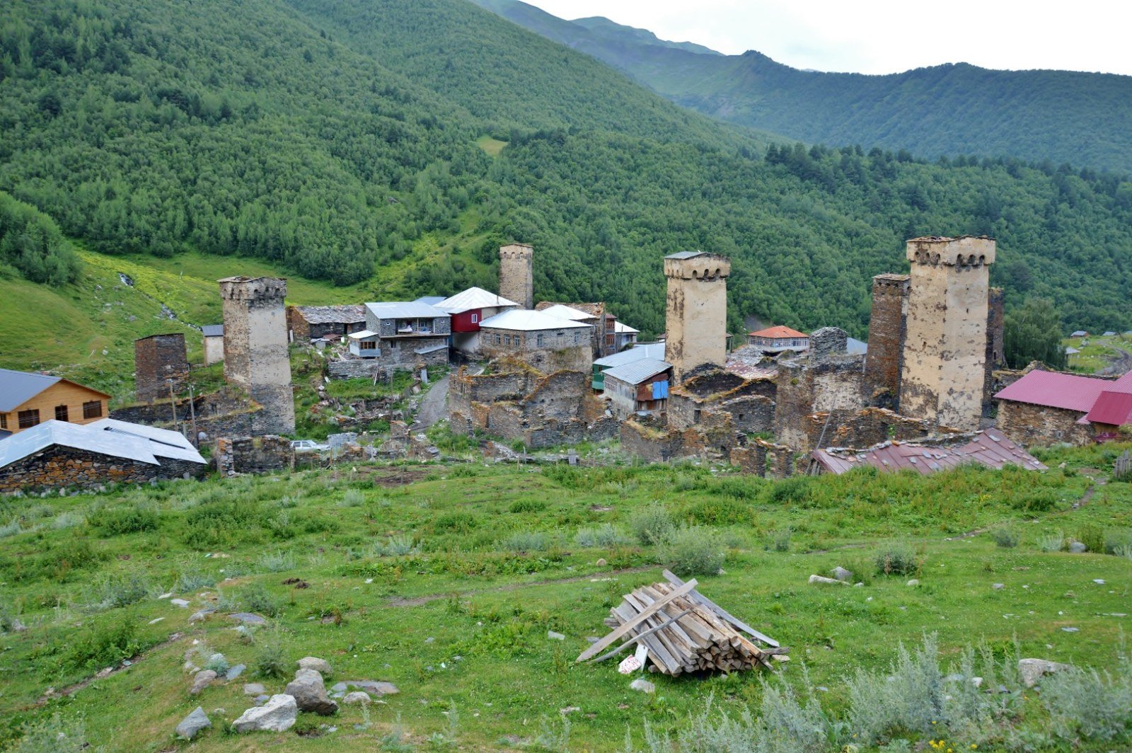
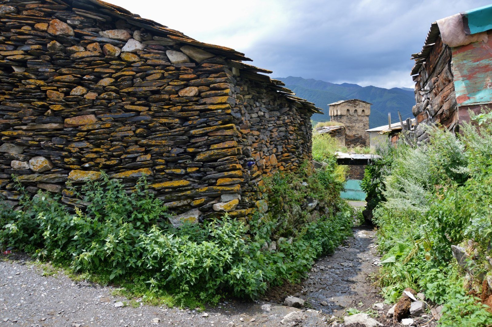
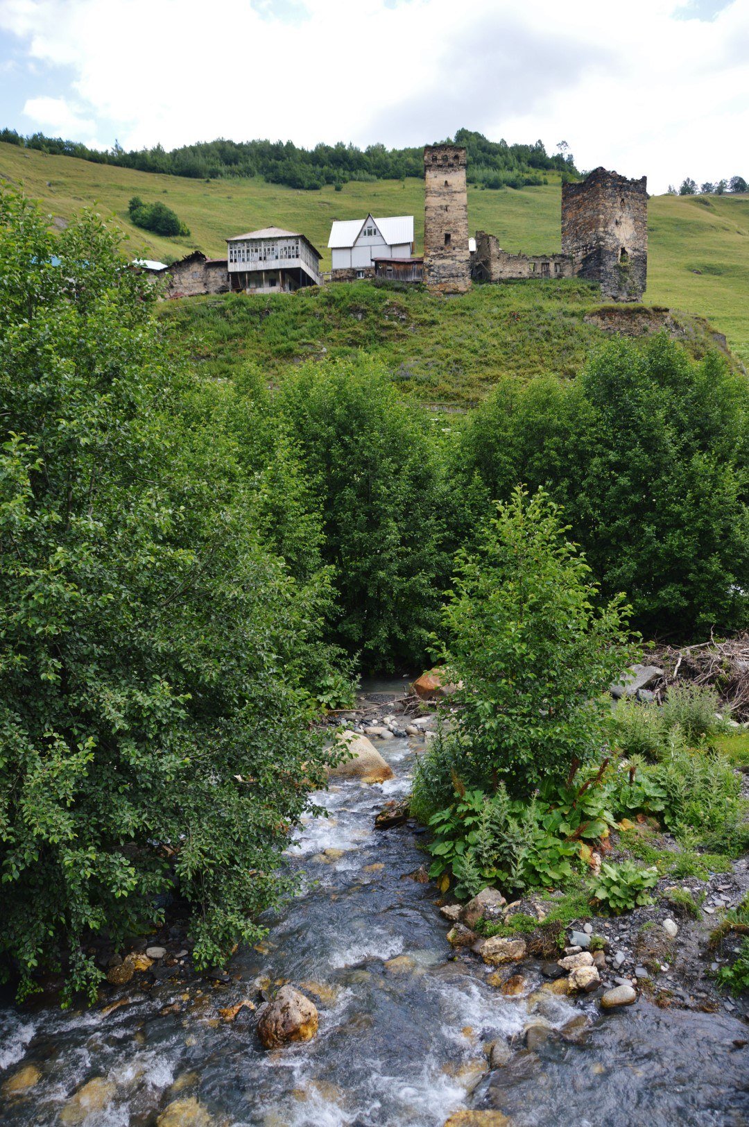
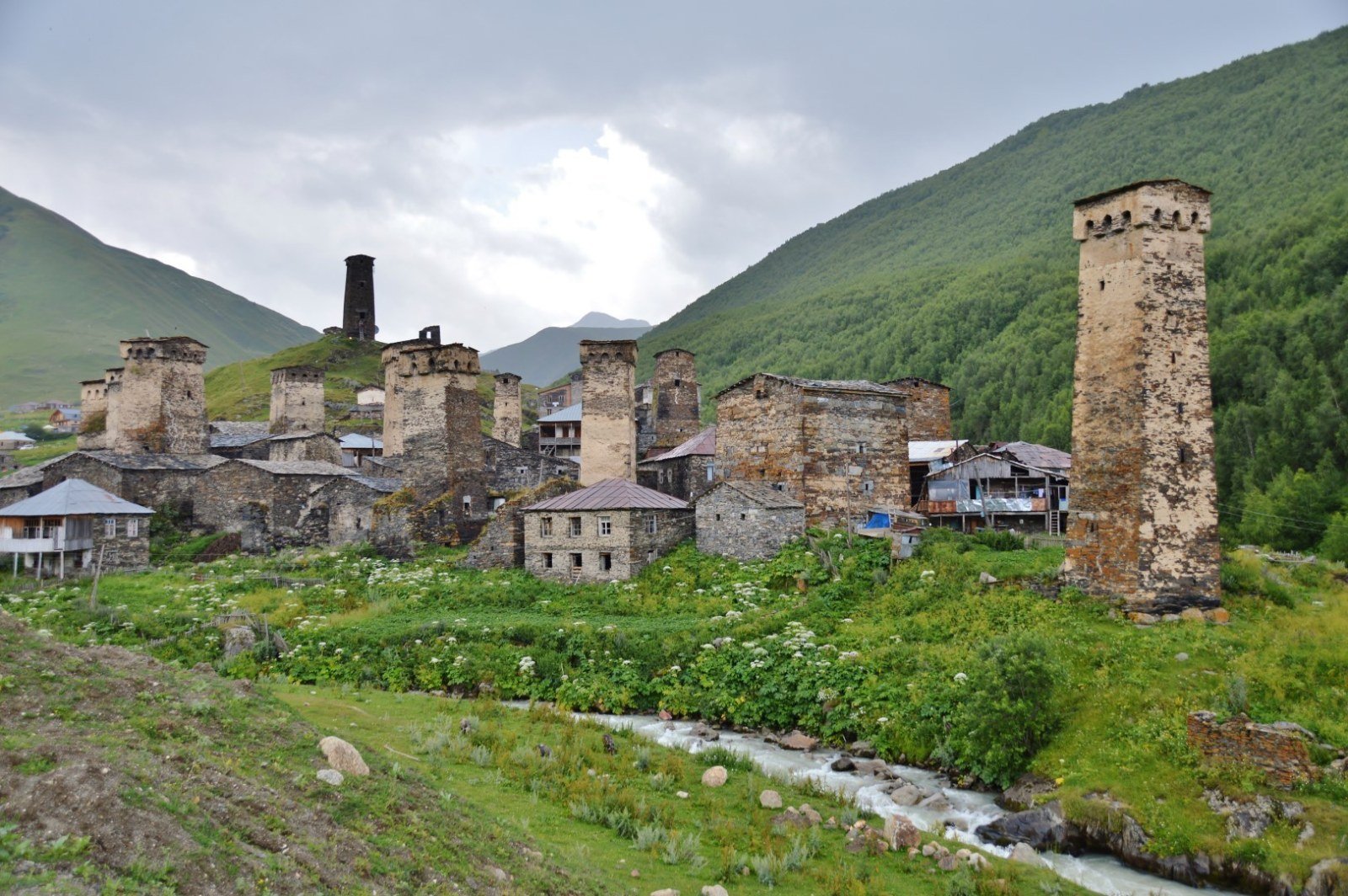
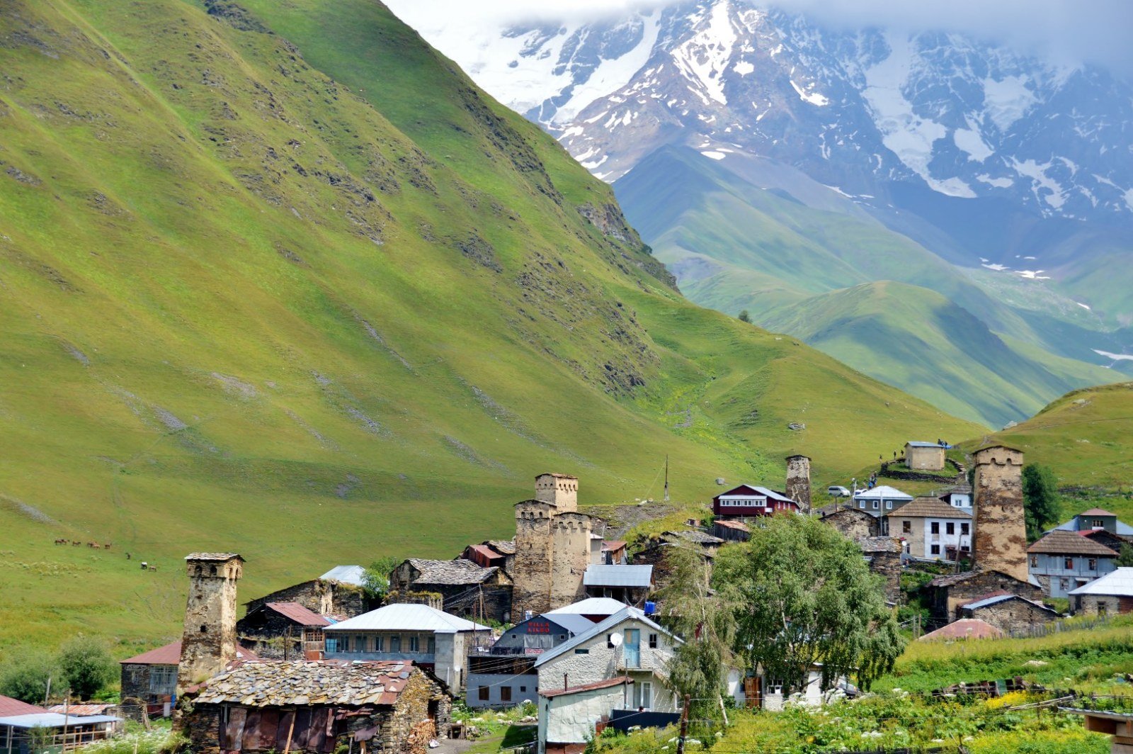
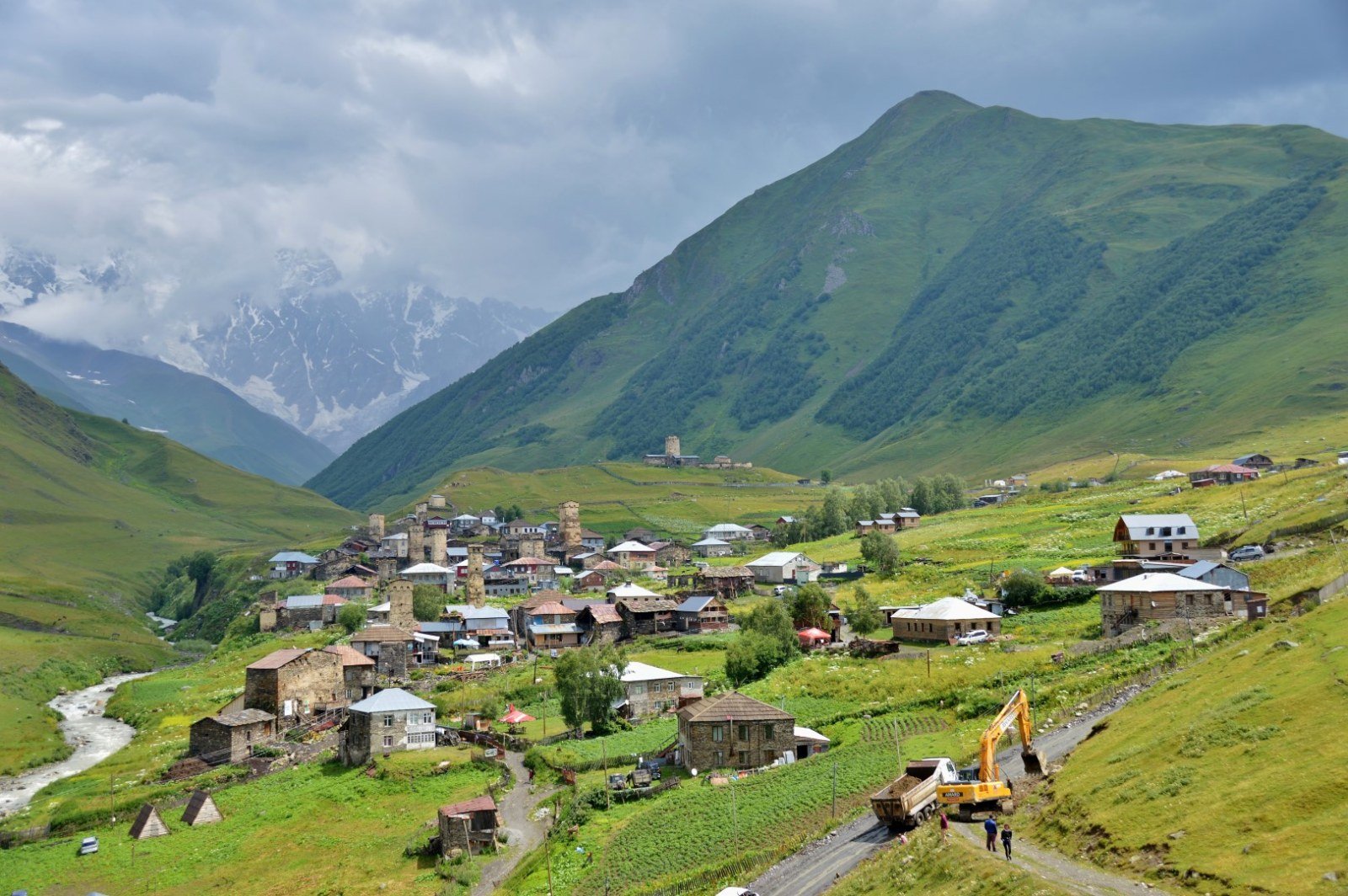
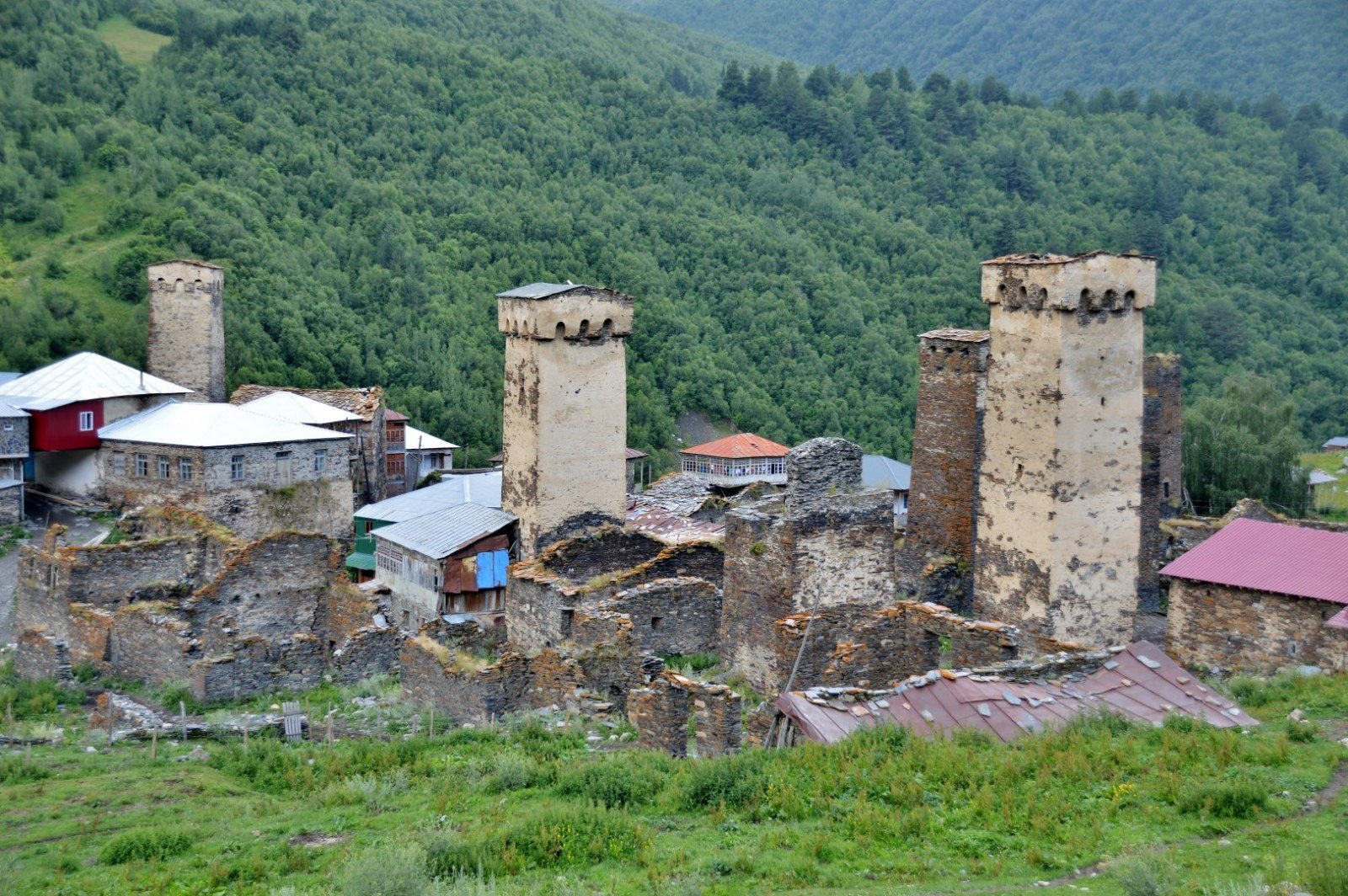
Ushguli is not a single village but four linked hamlets at the head of the Enguri valley: Chazhashi, Zhibiani, Chubiani and Murkmeli. You arrive by 4x4 from Mestia along a dirt track that takes between two and four hours depending on the season, and the first thing you see as you round the final rise is the outline of more than twenty grey stone towers pointing at the grey sky. In the background, the Shkhara glacier — which descends from Georgia’s highest peak at 5,193 metres — closes the horizon with a white mass that looks too large for the space it occupies.
The streets between the hamlets are unpaved. After rain, mud can reach your ankles, and in July, with the fresh snowmelt, some sections become a serious quagmire. Wellington boots are not an excessive precaution even in the middle of August. The atmosphere mixes the everyday with the touristy in uneven doses: there are guesthouses with clean beds and freshly baked khachapuri with Svan cheese, but also craft and wool stalls set up along the paths. In July and August, visitors comfortably outnumber the fewer than one hundred permanent residents.
The light at dusk, when the sun drops behind the ridges of the Greater Caucasus and tints the towers ochre, is when Ushguli feels most like itself. Without organised groups, with the smell of woodsmoke and the sound of the swollen Enguri river, the historical weight of the place becomes tangible.
History
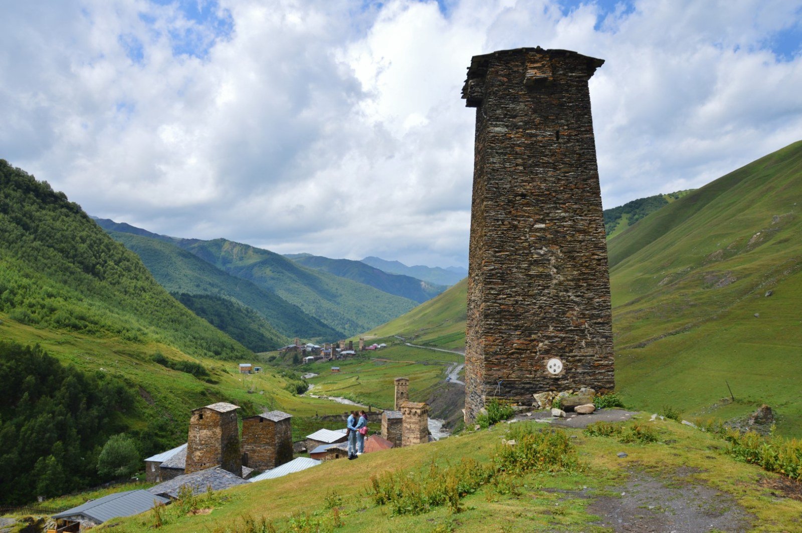
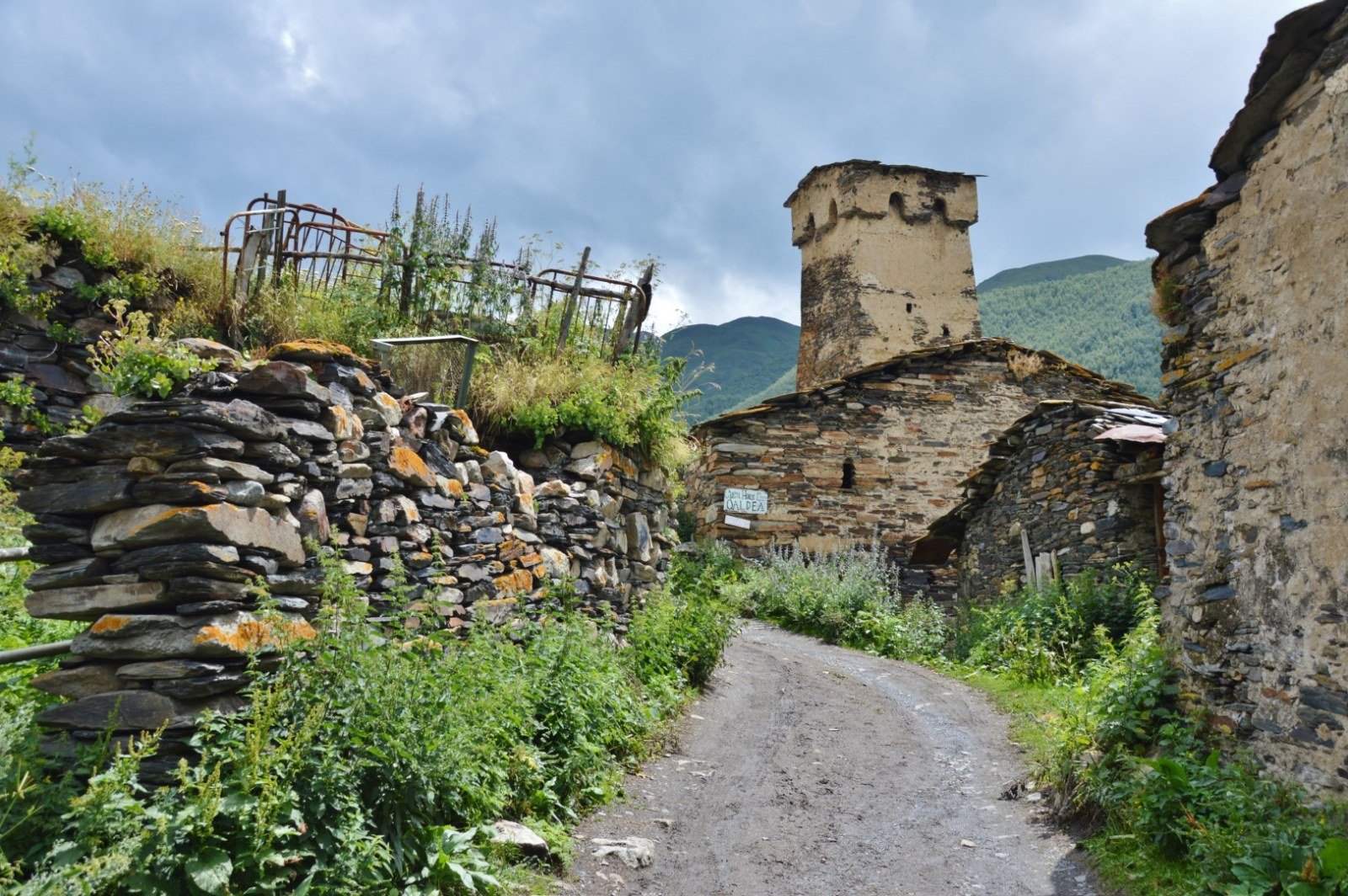
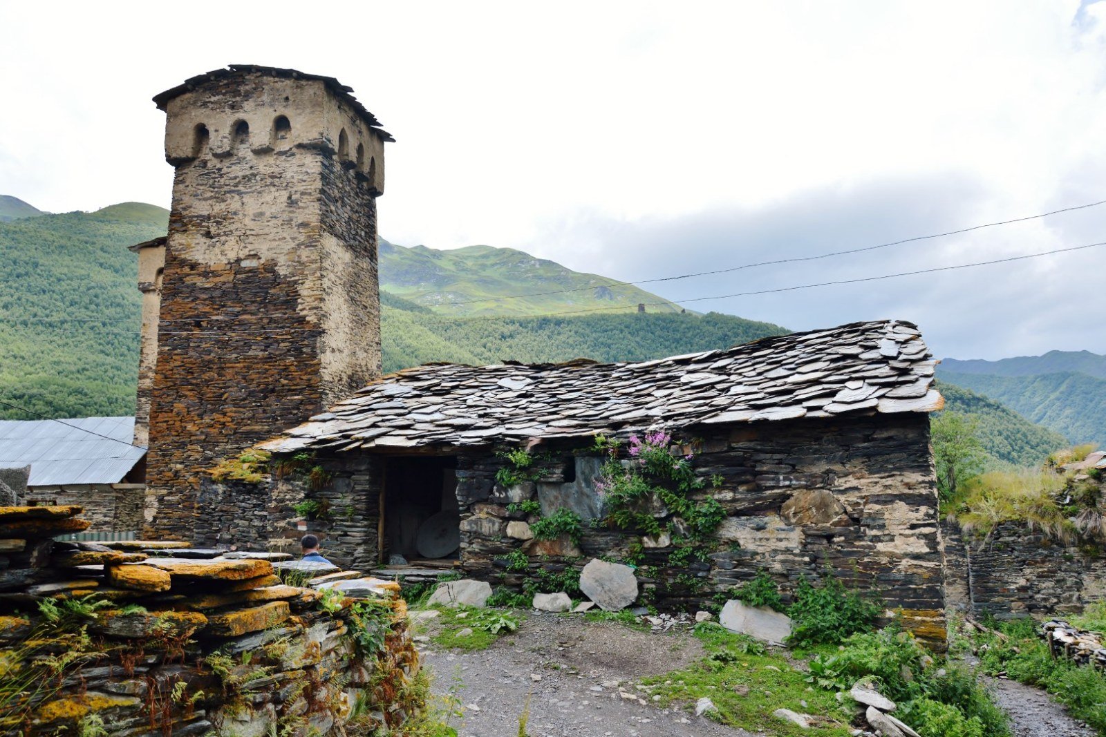
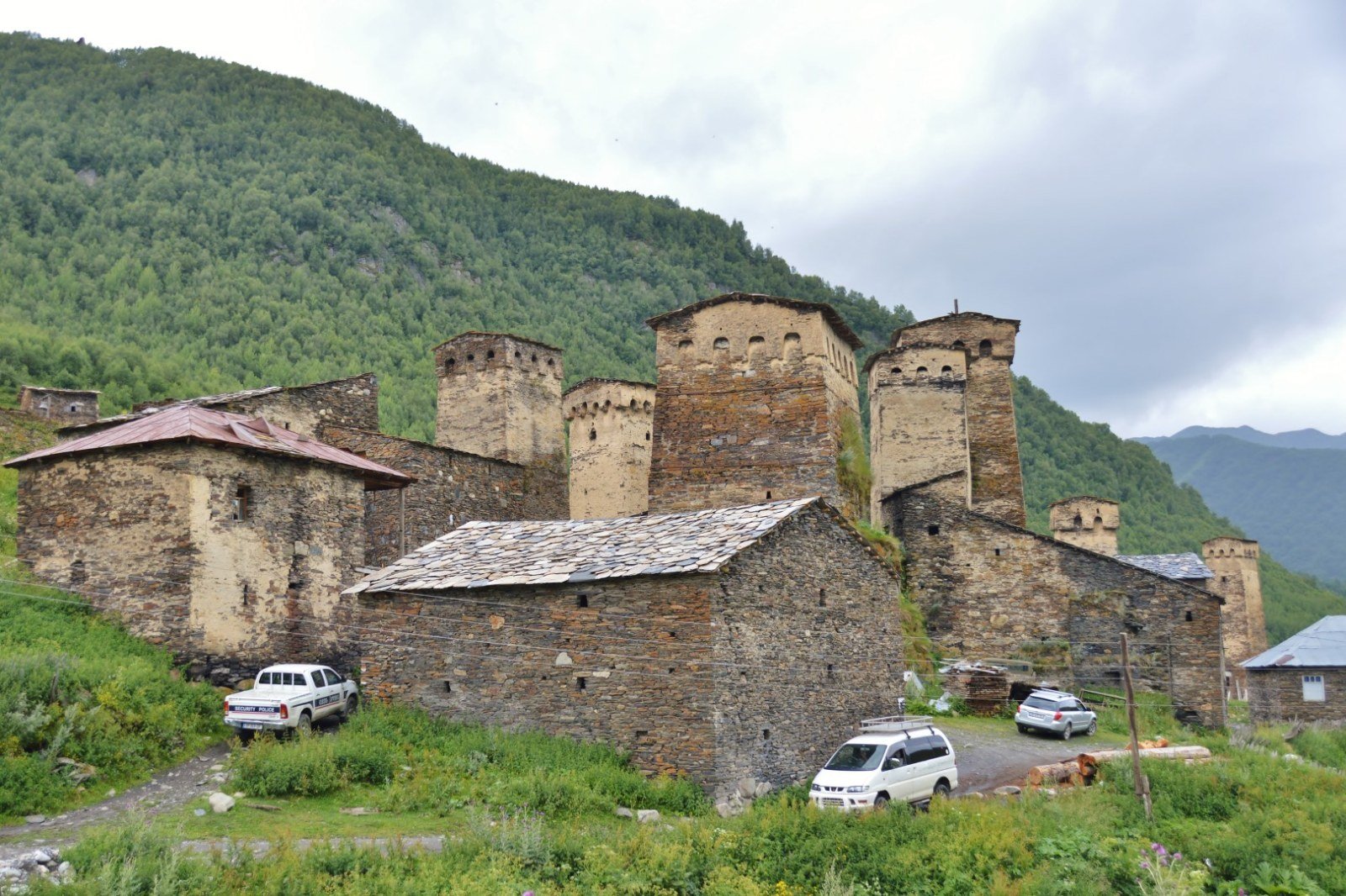
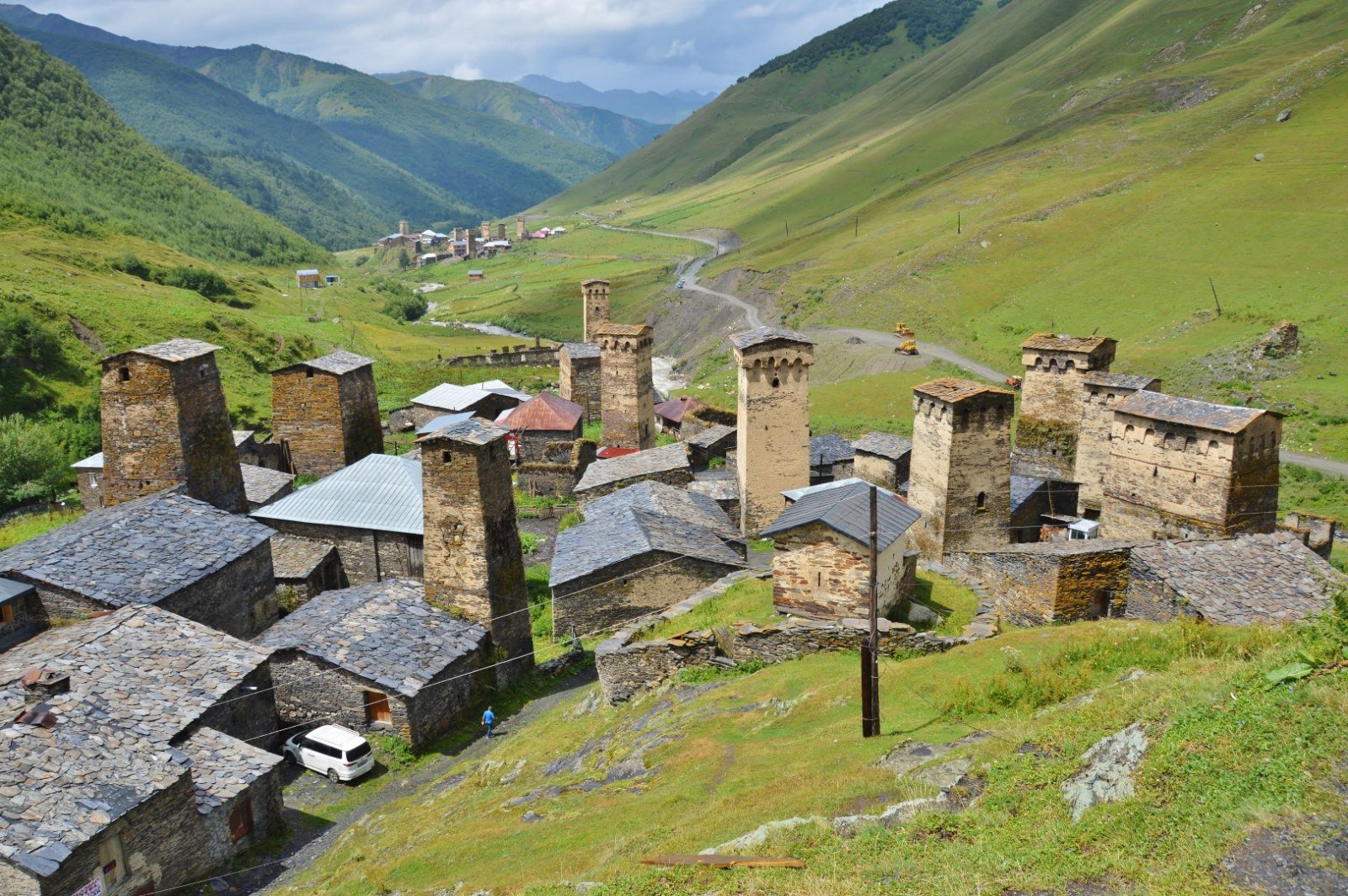
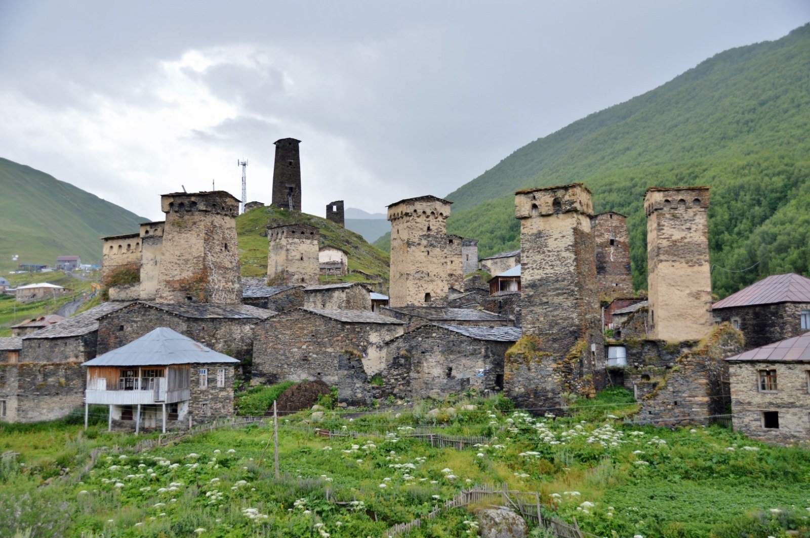
The Svans have inhabited this valley since before the Middle Ages. Their towers — built between the 9th and 13th centuries as defensive refuges and symbols of family power — are the most recognisable element of Svaneti’s architecture; each noble family raised its own, and some exceed 28 metres without using mortar. Ushguli was added to the UNESCO World Heritage list in 1996 as part of the ensemble of villages of Upper Svaneti. During the Soviet period, the region’s geographical isolation preserved both its architecture and its customs, though it also held back infrastructure development. The dirt track linking Mestia and Ushguli was not improved until well into the 21st century.
What to see & do
- Svan towers of Chazhashi The defensive structures, between 20 and 28 metres tall, that make up the densest concentration of the whole ensemble. Built dry, without mortar, some lean visibly with age. Several owners let you climb up for an informal fee.
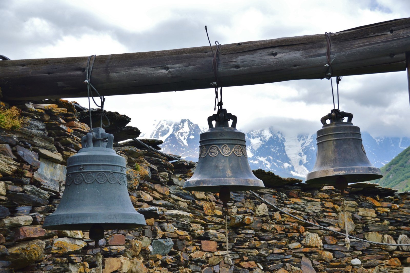
- Shkhara glacier The backdrop of the valley. Mount Shkhara (5,193 m) is the highest point in Georgia, and its glacier descends to elevations visible with the naked eye from the villages. A roughly three-hour return walk from Ushguli leads to the glacier front, crossing meadows and moraines.
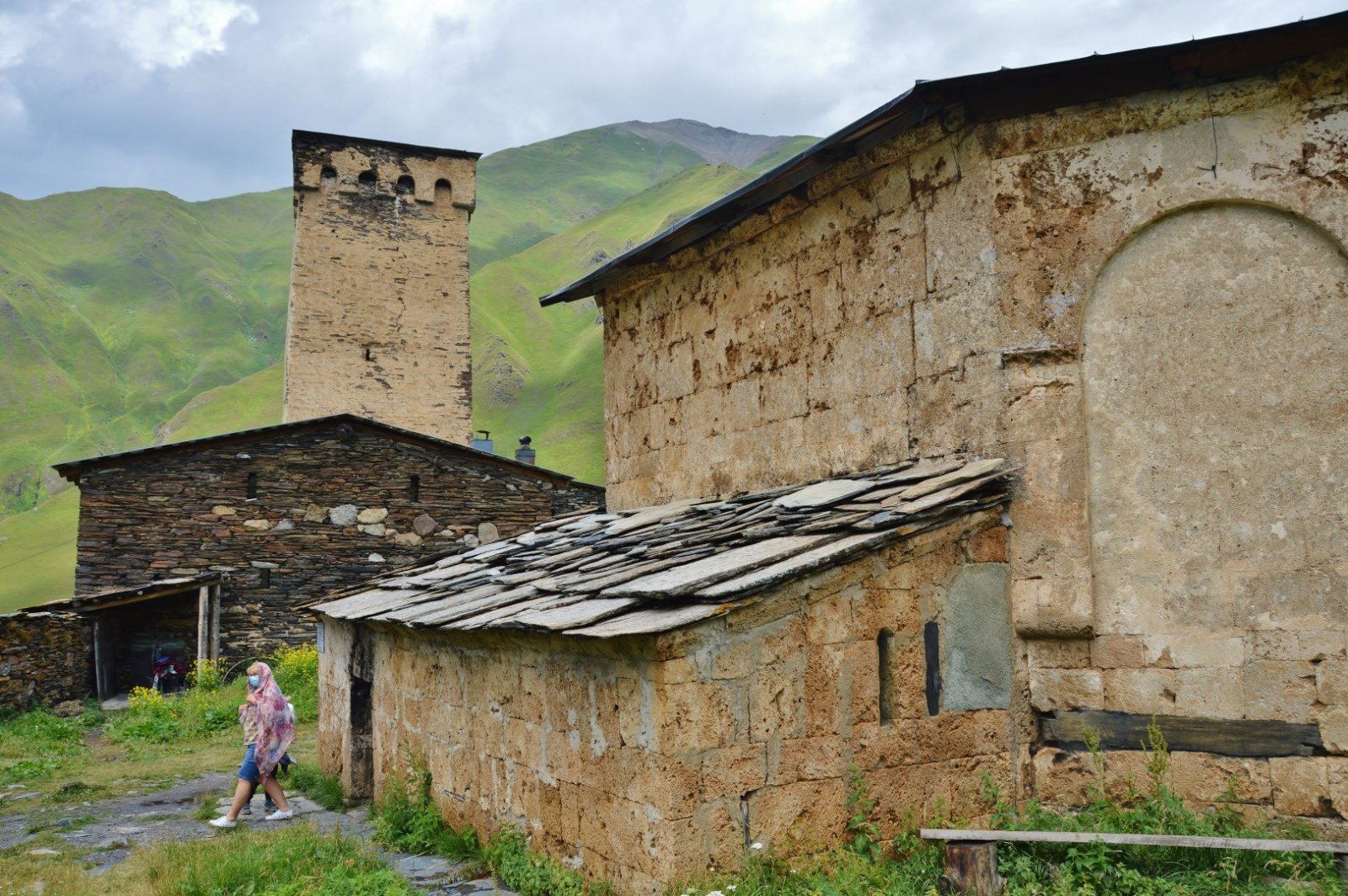
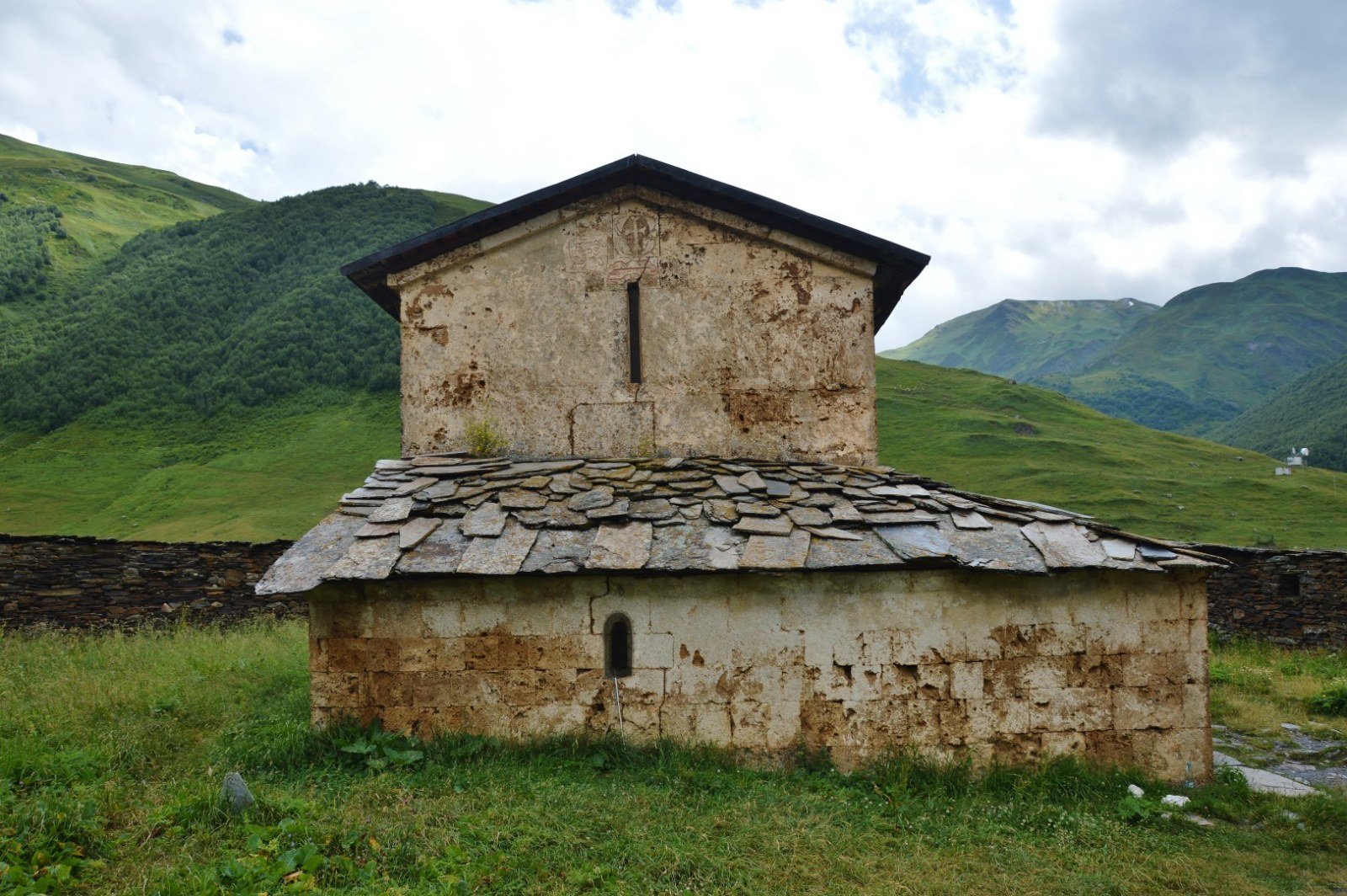
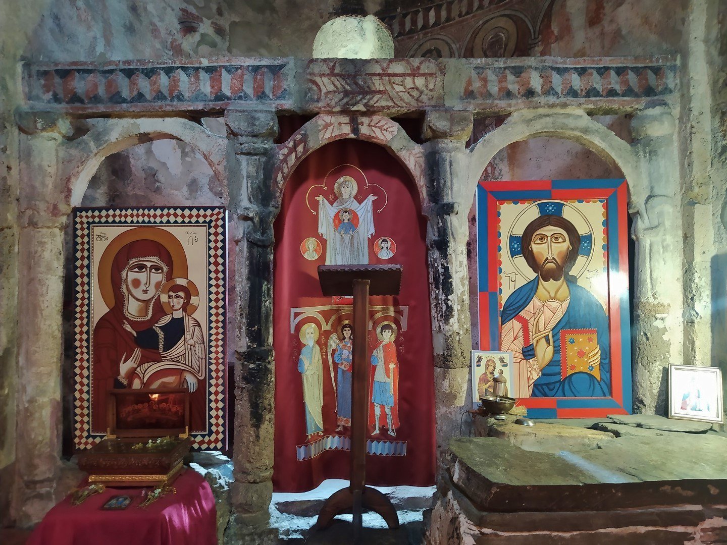
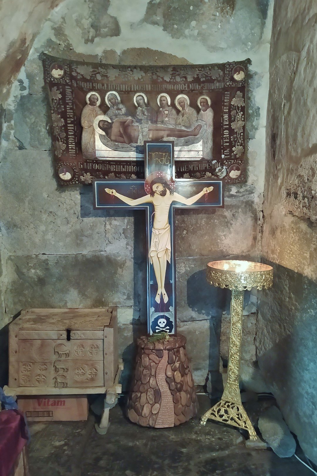
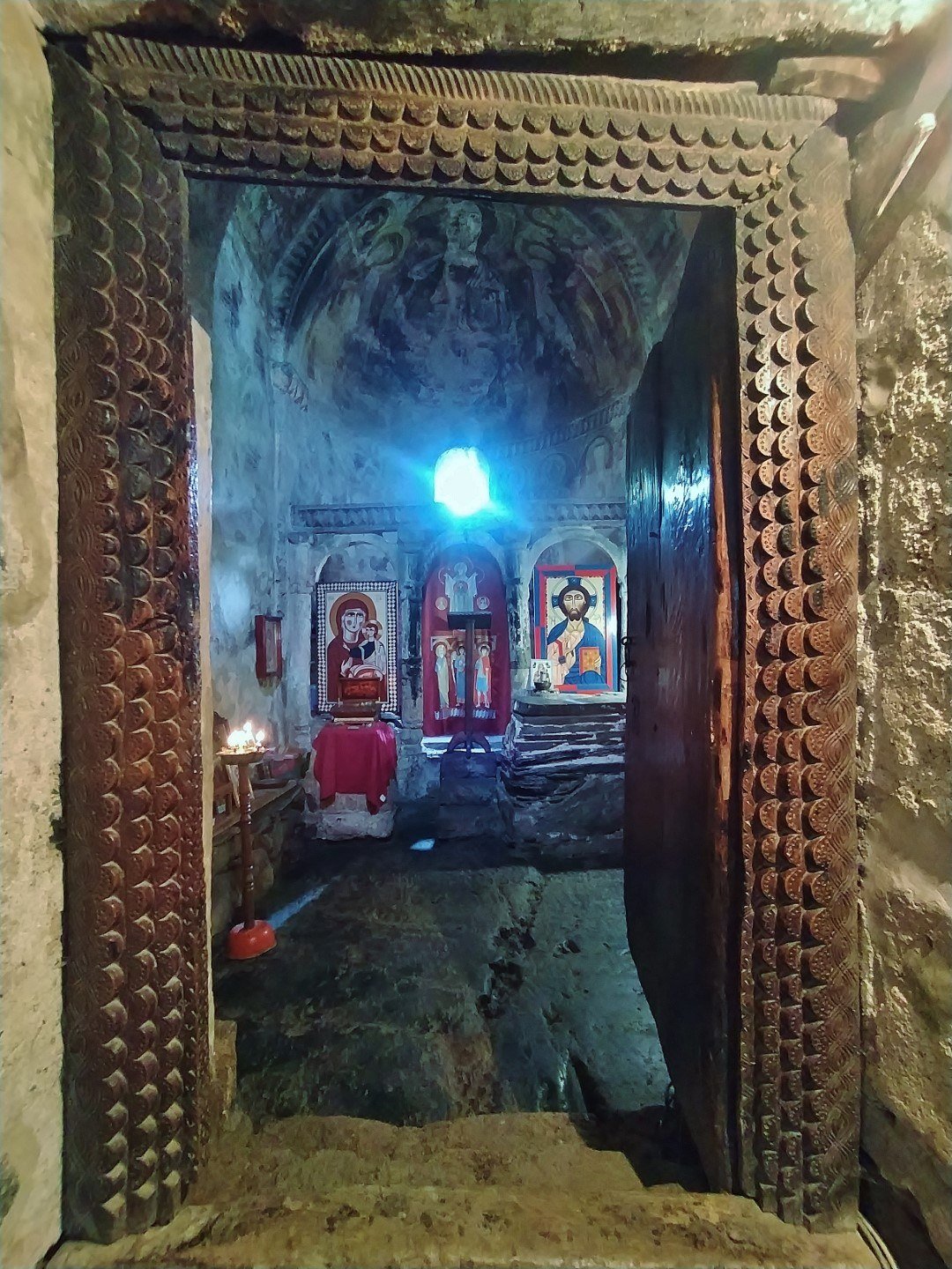
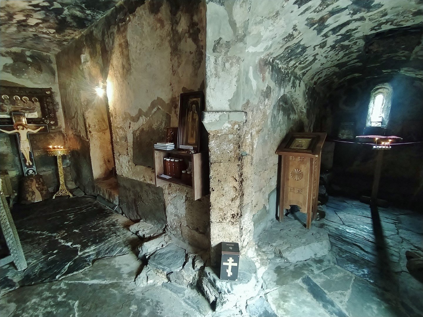
- Lamaria church A medieval church in the hamlet of Chazhashi, dedicated to the Svan Deipara. The walled enclosure includes a tower, auxiliary buildings and a bell tower. The interior preserves frescoes and a finely worked iconostasis.
- Murkmeli hamlet The highest of the ensemble, with direct views of the Shkhara glacier and fewer visitors than Chazhashi or Zhibiani.
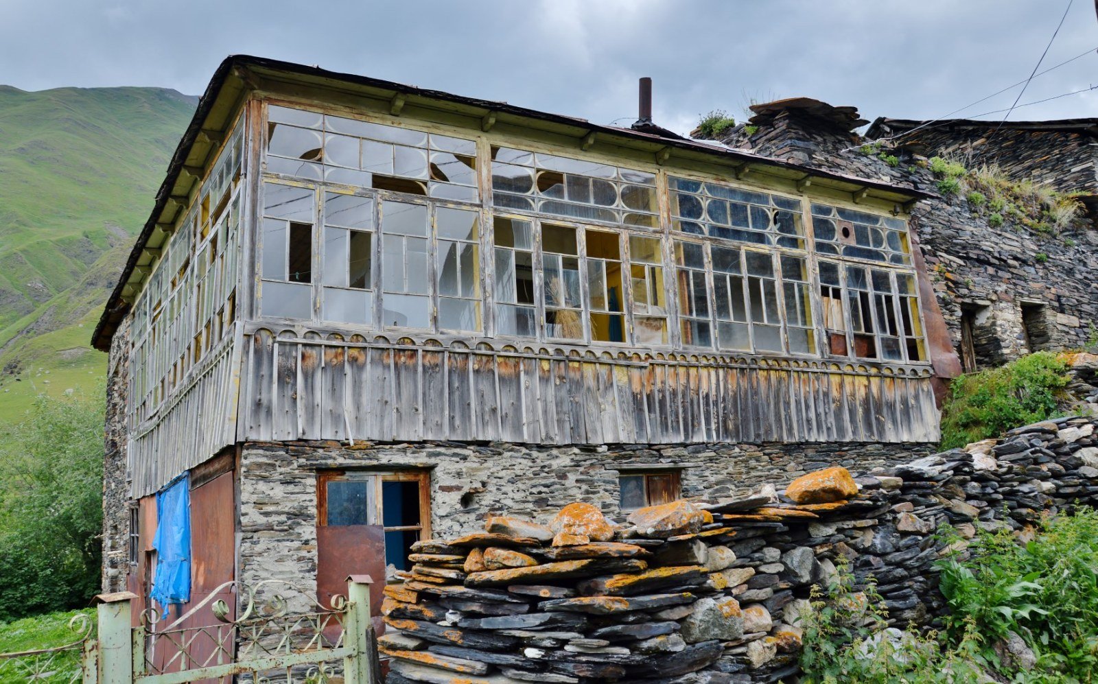
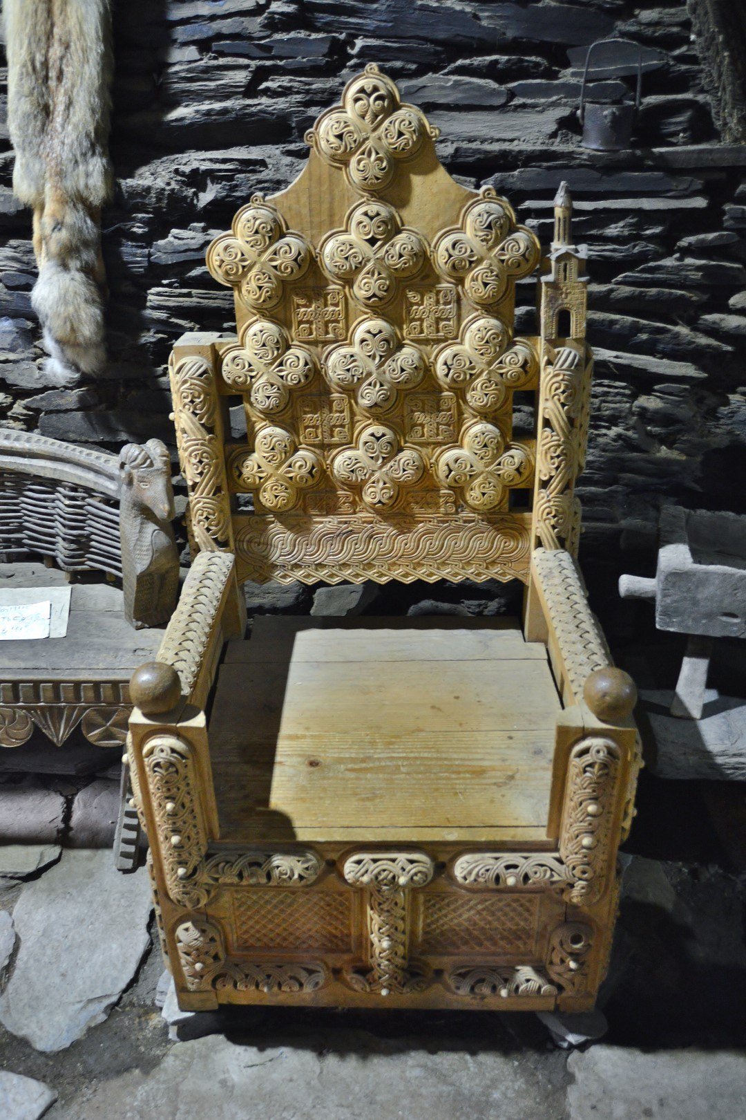
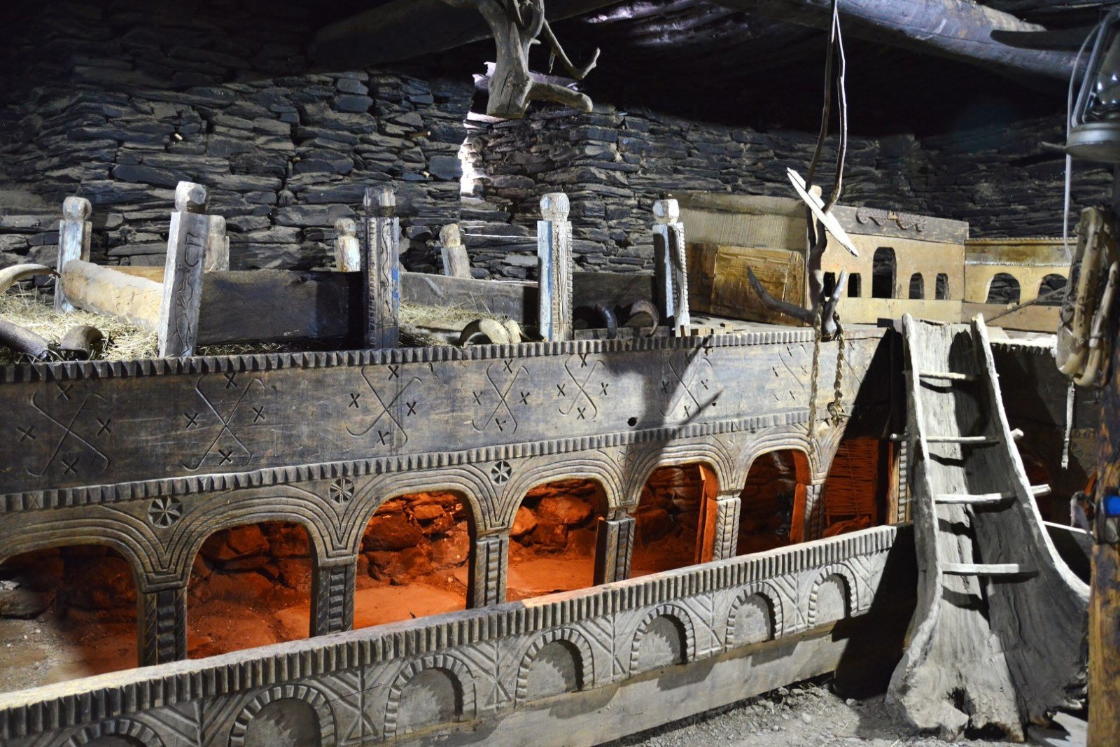
- Ethnographic house-museum of Zhibiani A restored traditional Svan dwelling in the hamlet of Zhibiani, with original furniture, utensils and architectural elements, including the machubi, the typical central hearth.
- Queen Tamar’s Castle Hill A small promontory above Chazhashi from which the whole ensemble of hamlets and the confluence of the Enguri river with the Shavtskala Kvishara can be seen.
Photo gallery
How to get there
Ushguli lies about 45 km south of Mestia along a dirt track that requires a 4x4 vehicle, especially in spring and autumn. In summer, daily shared taxis leave from Mestia. Mestia is reachable by small plane from Tbilisi (about 45 minutes) or by marshrutka from Zugdidi (4-5 hours), a city connected to Tbilisi by direct train. The Mestia–Ushguli track can be closed by snow between November and May.
Best time to visit
The main season runs from June to September. July and August are the busiest months; in June the track may be in poor condition due to snowmelt. September offers fewer visitors, clearer air and the first autumn colours on the slopes of the Greater Caucasus. In October the track begins to deteriorate with the first snowfalls. From November to May, Ushguli is practically cut off by land.
Photo: Iberogeorgia · proprietary