Smbataberd Fortress
Սմբատաբերդ
Medieval Armenian fortress on a ridge above the <strong>Arpa valley</strong>, in <strong>Vayots Dzor</strong>, with views of <strong>Noravank Monastery</strong>.
Location in the Caucasus
Description
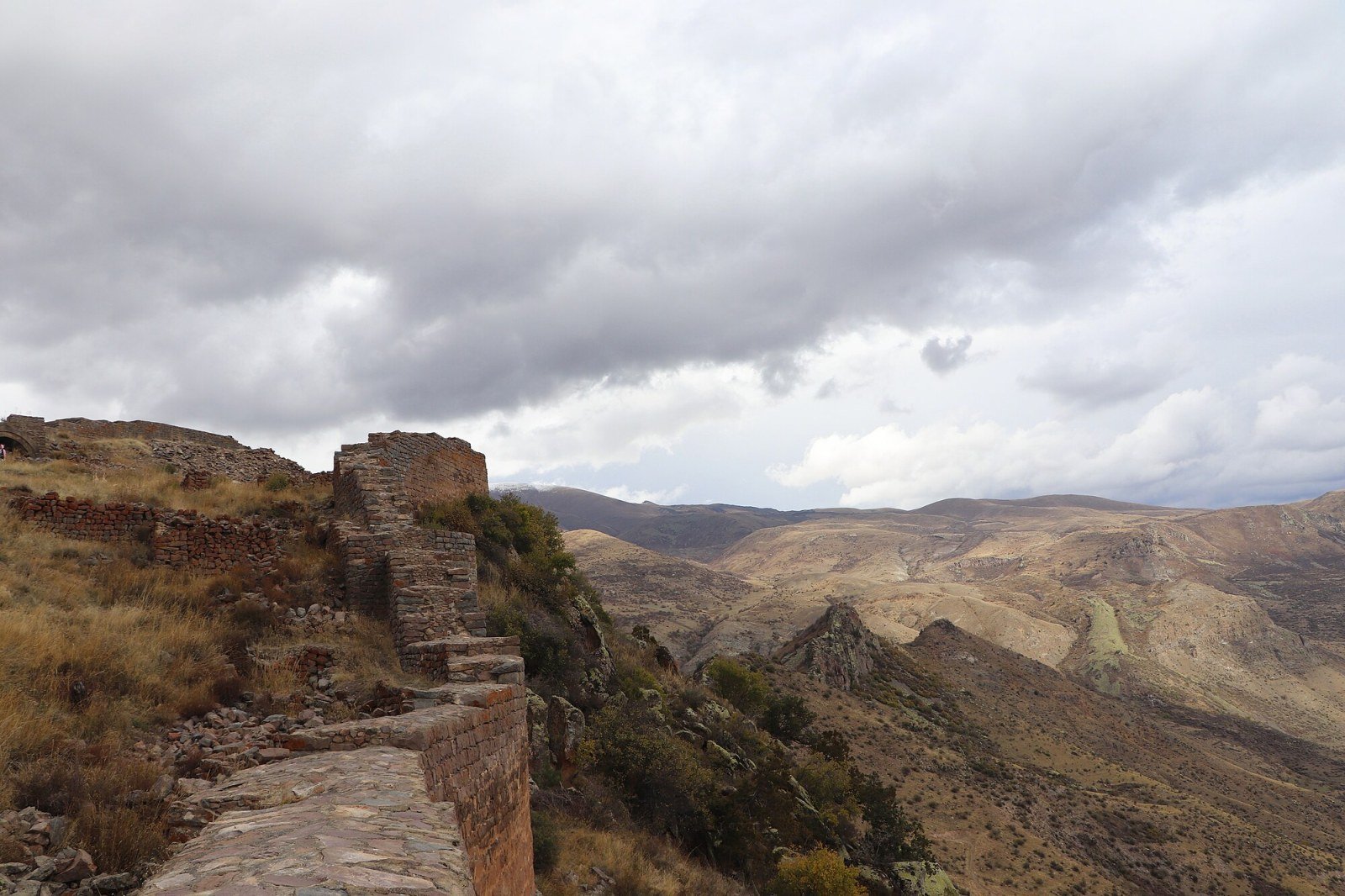
Smbataberd Fortress cannot be seen from the road. To reach it you must hike from the village of Artabuynk, climbing about 400 metres through juniper scrub and stony pastures. When you reach the ridge, the walls appear at the edge of the ravine: a strip of carved stone following the contour of the rocky spur for several hundred metres. Access is free, with no ticket office or fixed hours.
The state of preservation of Smbataberd is uneven. Some towers retain their original height and allow you to look out over the void; others are just heaps of blocks. There is no fencing or guard, so you can walk along the tops of the walls and enter the interior rooms without restriction. That has its charm, though it also means you should tread carefully in areas with loose blocks.
The views from the ridge justify the effort: the Arpa river valley opens up below with its fields and villages, and to the east, on clear days, you can make out the dark red gorge where Noravank Monastery sits. Combining both in a single day from Yeghegnadzor is common and well worthwhile.
History
Smbataberd Fortress was built between the 10th and 11th centuries by the Syuní princes to defend the kingdom of Vayots Dzor from raids by the Seljuk Turks. Its position on a ridge with vertical drops on both sides made it practically impregnable by direct force; the weak points were the approach from the northern end and the water supply, a problem the builders solved by carving a cistern into the interior rock. The walls visible today are mostly from that period, with later repairs. Smbataberd was definitively abandoned after the Mongol invasion of the 13th century and was never systematically rehabilitated.
What to see & do
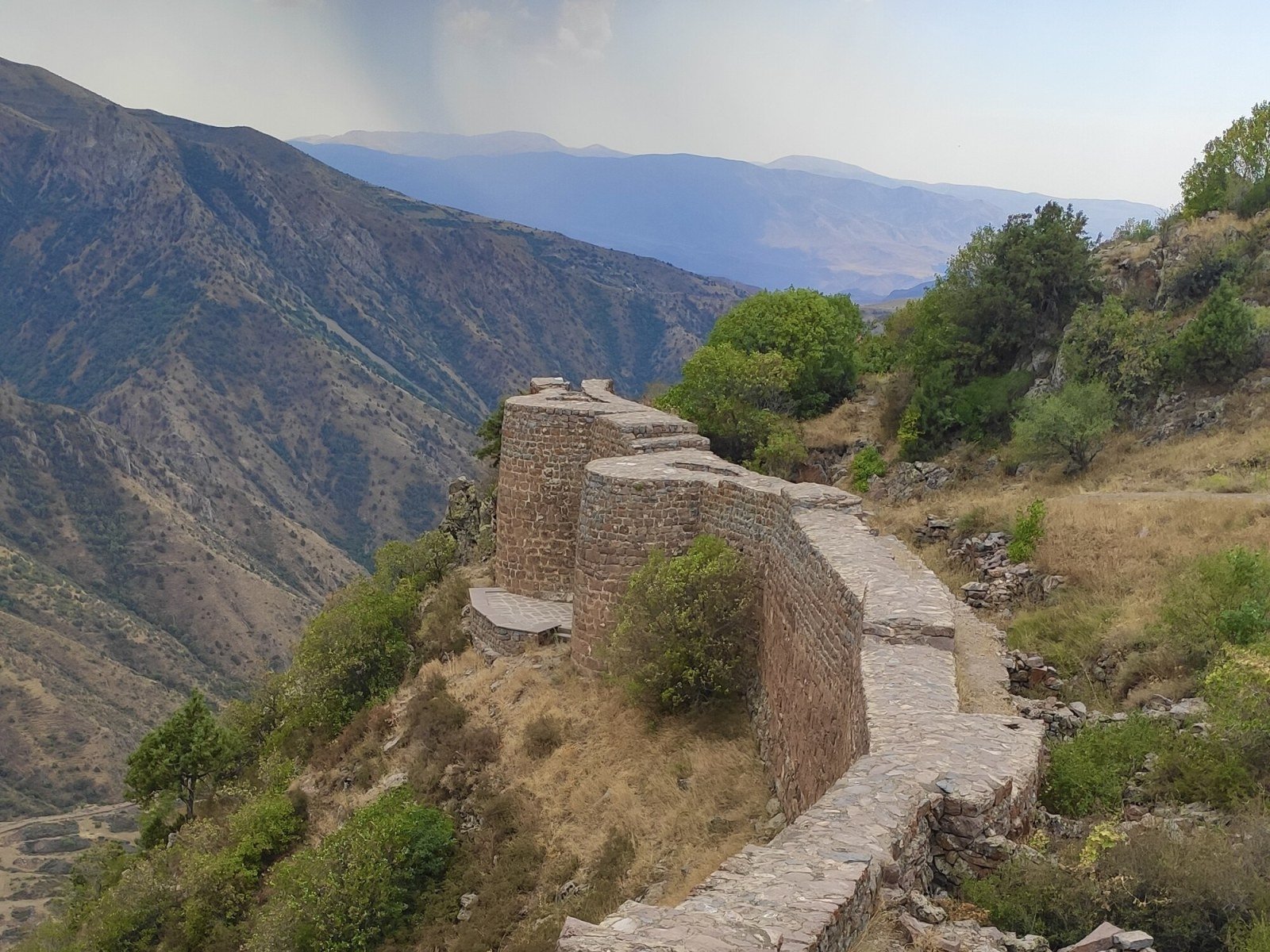
- North and south towers The two best-preserved towers of Smbataberd give a sense of the original height of the defences. From the south tower there are direct views over the ravine and, on clear days, over the Arpa valley.
- East wall The longest section of the enclosure follows the ridge line with several buttresses and remains of interior steps; it is the best stretch to walk the full perimeter on foot.
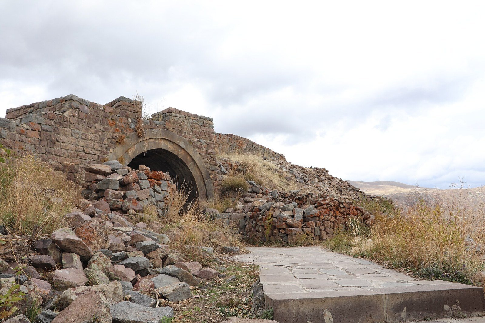
- Rock-cut cistern A water reservoir carved into the interior of the enclosure, proof that Smbataberd was designed to withstand prolonged sieges without relying on the outside.
- Views of Noravank Monastery From the southern end of the ridge, on clear days, you can make out the red gorge where Noravank Monastery sits, about 12 km as the crow flies.
- Tsakhats Kar Monastery About 8 km along a dirt track, another medieval monastic complex in Vayots Dzor that complements a visit to Smbataberd well without needing to return to Yerevan.
Photo gallery
How to get there
Access starts from the village of Artabuynk, about 6 km from Yeghegnadzor along a dirt track passable in a normal car. From Yeghegnadzor taxis take you to the start of the trail. Yeghegnadzor is about 2.5 hours from Yerevan by marshrutka from the central station. There is no public transport to Artabuynk. The trail from the village to Smbataberd Fortress takes between one and a half and two hours going up.
Best time to visit
The best time is May to October. In spring the pastures are green and the trail presents no technical difficulties. In summer the heat bears down during the ascent; it is best to set off before 9 am. Autumn offers clear skies and bright light. In winter the trail can become snow-covered and slippery, and car access to Artabuynk becomes complicated. Bringing enough water for the ascent to Smbataberd is essential at any time of year.
More information
Photo: Dav Sargsyan · CC BY-SA 4.0